


Created by

avitajackson
Author's Instructions
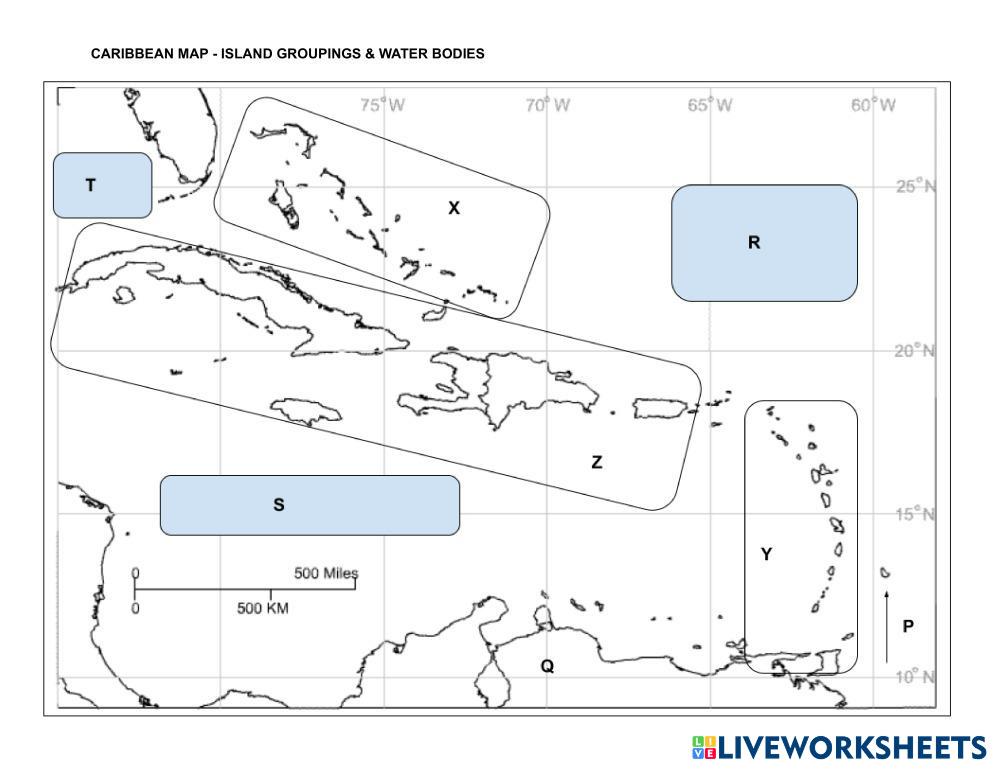
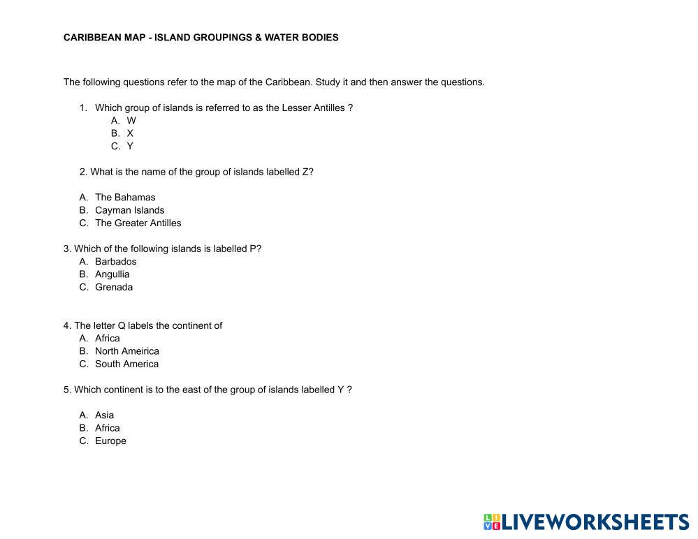
This interactive worksheet helps students explore the Caribbean region by identifying the Caribbean islands, understanding how they are grouped into island chains (Greater Antilles, Lesser Antilles, Leeward and Windward Islands), and recognizing the major water bodies surrounding the region, such as the Caribbean Sea, Atlantic Ocean, and Gulf of Mexico. Students will label maps, match island groupings, and answer questions to reinforce their knowledge of Caribbean geography.
My Google Classroom Courses

Quick Access
All Classes


Created by
avitajackson
Author's Instructions
This interactive worksheet helps students explore the Caribbean region by identifying the Caribbean islands, understanding how they are grouped into island chains (Greater Antilles, Lesser Antilles, Leeward and Windward Islands), and recognizing the major water bodies surrounding the region, such as the Caribbean Sea, Atlantic Ocean, and Gulf of Mexico. Students will label maps, match island groupings, and answer questions to reinforce their knowledge of Caribbean geography.
Explore Worksheets
nn
- Social Studies
- 6th grade

اغلفة كوكب الارض
- Social Studies
- 6th grade

Volcanic Mountain Report
- Social Studies
- 6th grade

قارة أفريقيا
- Social Studies
- 6th grade